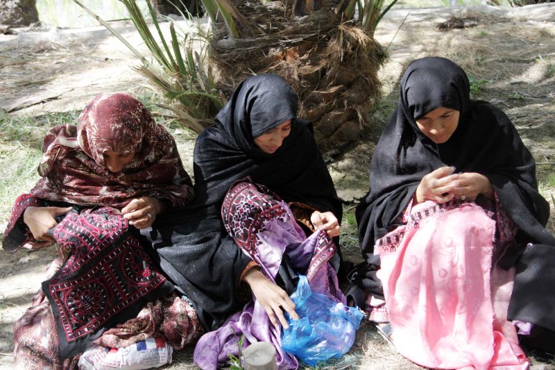
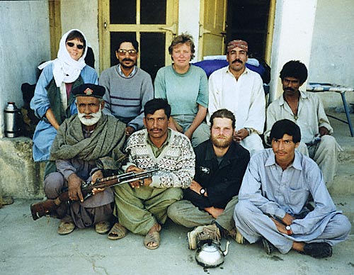
Balochistan Archaeology,foto.
 خريطة بلوشستان كتب عليها باللغة الانكليزية " دولة البلوش "
علم بلوشستان المحتلة


بلوچستان دستورپخت و مناس


| | 5 The Third Millenium BC: 3000 - 2500 BC | | Niai Buthi | |
|
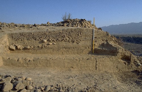
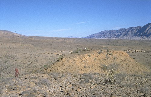
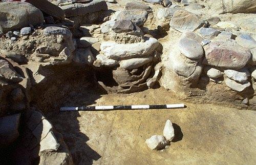
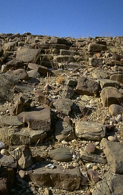
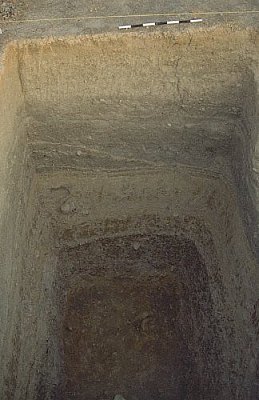
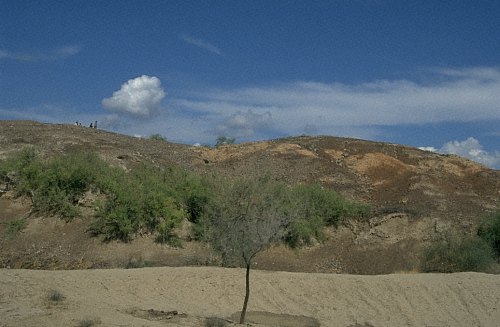
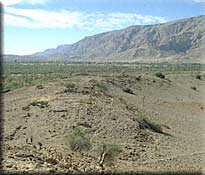
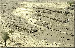
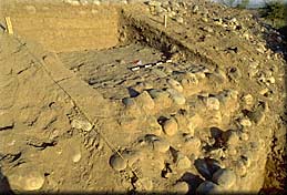
 Niai Buthi is the most impressive early 3rd millennium BC site in the plain of Las Bela. It is 13 hectares large and 13 meters high (32). Two trenches were opened in 1999 (33, 34,35). Virgin soil was not reached, but the levels exposed at plain level correspond to the last phase of occupation at Adam Buthi. In addition to purplish slipped unpainted pottery, Togau B and Kechi Beg pottery was found (36). Two trenches were opened in 1999 (37, 38, 39). During the early 3rd millennium BC. the site reached its maximum extension. Well-built stone and mud brick architecture was exposed in the sections and on the surface. In the east, several stone-lined hearths and dump pits containing animal bones and a large number of discarded and broken pots were excavated (40, 41, 42). |
|
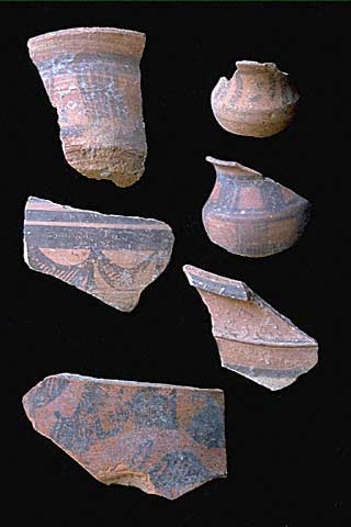
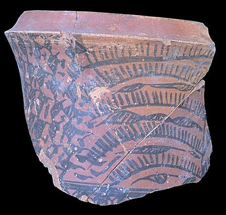
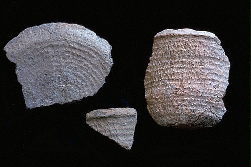
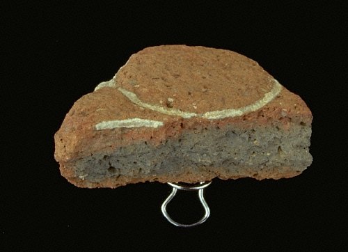
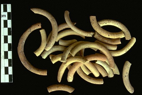
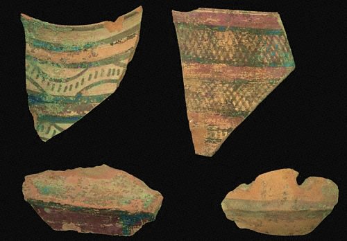
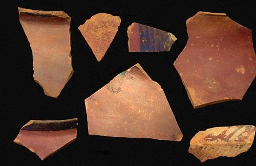
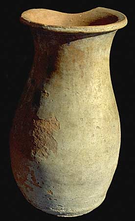
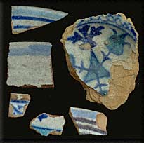
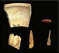
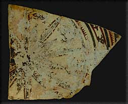
 Apart from the typical buff "Nal"-pottery with black paint, fine orange and coarser household wares (43,44), polychrome vessels, partly still complete, were unearthed (45, 46, 47, 48). A single Faiz-Mohammad Grey ware sherd (49) and a chlorite fragment with an imbricate design are important finds since they provide cultural links to the north and the west. The pottery changes through the levels. Polychrome sherds are outlasted by monochrome Nal wares and in the upper layers of trench II carinated bowls with hammer-head rims and reddish-brownish slips foreshadow the later Kulli pottery (50). A typical motif is the single-bracket design which becomes a hallmark of the late 3rd millennium BC occupation (51, 52). |
|
| | Balakot | Balakot, which is located in the southeastern Bela plain, was excavated between 1973 and 1976 by G.F.Dales, of the University of California, Berkeley. It is the only properly excavated site in the region. Despite its small size (ca. 4.5 hectares), the site is thus of crucial importance due to its long Early Harappan cultural sequence which is now dated to between 3100/3000 and 2600 BC. It is the southernmost findspot of Quetta- and Nal-pottery, but has also many affinities to Amri in Lower Sindh. Although the transition to the Harappan period (II) is stratigraphically not very clear, there appears to be a gap. Despite some pottery forms which continue into the later third millennium BC, the classical Harappan pottery appears suddenly and fully fledged at the site. Kulli elements are also present, but not as pronounced as at Nindowari or the many Kulli sites found in the Kanrach, Hab- and Saruna Valleys. |
|
| | Murda Sang | | |
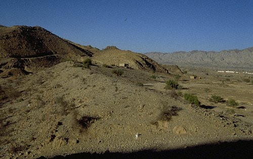
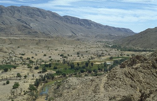
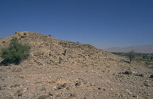
 Murda Sang is the largest prehistoric site in the Kanrach Valley (53). It was discovered in 1997 and trial trenched in 1998. The nucleus of the settlement consists of houses grouped along lanes and streets. This central portion is about 6ha large, but scattered occupation and a kiln area cover altogether ca. 35ha. The eastern edge is eroded by the Kanrach River (55). Two dams were found to the north of the site and we assume that fields were located there. The site and the whole valley are overlooked by a fortification built on top of a terrace hill at the southern edge of the site. |
|
| The soundings revealed two main periods of occupation, the lower with three very compact building phases, the upper one with two. The ground was terraced with gravel and pottery before construction. | |
 The ground was terraced with gravel and pottery before construction. Houses have a stone foundation, but mudbricks were also used (54, 56), the roof was covered with mud-smeared reed. The pottery from the earlier occupation is very similar to that from the earlier levels of Balakot I (57, 58, 59, 60). An AMS date run on charcoal suggests a dating into the very early third millennium BC. After 2700/2600 the site was abandoned. The uppermost, badly preserved occupation dates to the later Kulli period. Very small parts of the site were re-used during the late Islamic or British period. A very large platform-house site of the Historic Period was built over scattered houses and possibly fields north of the main settlement. |
|
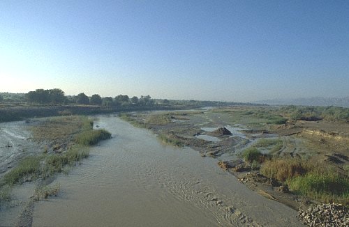
| A sounding revealed a sequence of finely banded sand and mud layers (61). This evidence and the accumulation of humus above the old gravel surface indicate frequent flooding (62). Most probably, the river and wadis which have deeply cut their bed into the rock, flew at a very different level 5000 years ago. A substantial change in the topography and drainage pattern since the 3rd millennium BC thus appears likely. > 6 | |


| | 2 Introduction | | |
 The prehistoric period was certainly the most prosperous period in this cycle: during in the earlier 2nd millennium BC, the settlements were abandoned and no human traces left, whereas after a short intermezzo during the Historic Period, the sites clearly reflect that away from the cultural, economic, and political centers, migratory pastoralism and a nomadic life-style was the only mode of subsistence and land use. The prehistoric period was certainly the most prosperous period in this cycle: during in the earlier 2nd millennium BC, the settlements were abandoned and no human traces left, whereas after a short intermezzo during the Historic Period, the sites clearly reflect that away from the cultural, economic, and political centers, migratory pastoralism and a nomadic life-style was the only mode of subsistence and land use.The earliest site, Adam Buthi, dates to the 4th millennium, but the early 3rd millennium BC was a period of growth in terms of number and size of settlements. Many sites appear to be associated with dams. |
|
 The pattern is very similar during the later 3rd millennium, but then occupation was either restricted to a small area of an earlier site, or sites were newly founded. This late Kulli occupation to which the largest number of sites in southern Balochistan belong, co-existed with the Indus Civilization (Kanri Buthi). The presence of quite a number of town-like settlements added a new and unexpected dimension to this cultural complex and to an area which sofar had remained in the shadow of the Indus Civilization. These new and exciting findings require a rethinking of models of interaction and center-periphery relations between these two areas. |
|
| After 1900/1800 BC the Indus Civilization disintegrated into several regional cultural complexes. In southeastern Balochistan, however, the settlements and irrigation systems were abandoned. No sites dating to the subsequent centuries were found. The only possible explanations are major population movements or a large-scale and enduring shift in subsistence economy and lifestyle. However, while the transition to a mobile lifestyle is attested to by hundreds of camp sites during the Islamic period, the second millennium BC is devoid of any human remains. |
|
| Likewise, none of the known regions experienced a massive influx of people during that time. On the contrary, areas such as Sindh and Punjab obviously experienced the same development. | |
 The next traces of settled life date to the so-called Historic Period. However, although some of the Achaemenian and Greek, Mauryan, Kushana, and Sasanian rulers and historians mention southern Balochistan in their records, archaeological correlates for their presence are rare: Settlement types, pottery and small finds are rather unknown and if no coins are at hand, dating is a hazarduous undertaking (Hadera Dhan). Diagnostic links to the north, where Pirak and the Swat Valley are well explored and Buddhist sites flourished have yet to be found. |
|
| The large number of prehistoric settlements, the size and sophisticated lay-out of some of them came as a surprise: nowadays the area is barren and inhabited by a few people. Interestingly, the sites indicate that a development from village to town and then to camp, and from agriculture to migratory pastoralism took place. | |
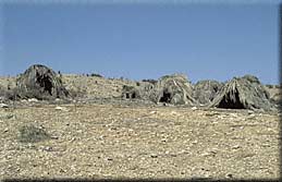
 The Islamic Period is marked by a few settlements and fortifications which are located in central areas of Las Bela and Sindh Kohistan or strategic positions in the Hab Valley (13), while no sites other than seasonal camps (14) which are marked by hundreds of "stone benches" and sherd clusters were found In the interior mountain valleys. These sites date to the 12/13th century AD, the 17/18th cent. and the British Period. The transition to a tribal society, and several conflicts and raids between different tribes and ethnic groups which also caused large-scale migrations were probably major forces behind this development. The Historic and Islamic Period are times of both cultural and economic growth, and of political strength and conflicts. |
|
 Many sites in Sindh, Punjab, and the NWFP mirror this development in one way or the other. Both affected the administrative and political centers, among which Bela, Nal-Kaikanan, and Khuzdar are the most important in this region, but not the remote mountain areas which until very recently were the sole domain of migrating tribes and clans. > 3 Many sites in Sindh, Punjab, and the NWFP mirror this development in one way or the other. Both affected the administrative and political centers, among which Bela, Nal-Kaikanan, and Khuzdar are the most important in this region, but not the remote mountain areas which until very recently were the sole domain of migrating tribes and clans. > 3 |
|
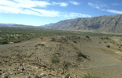
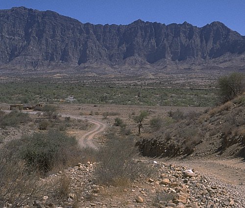
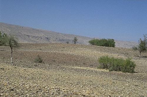
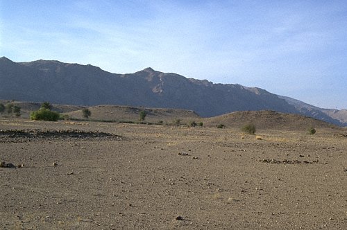
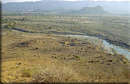
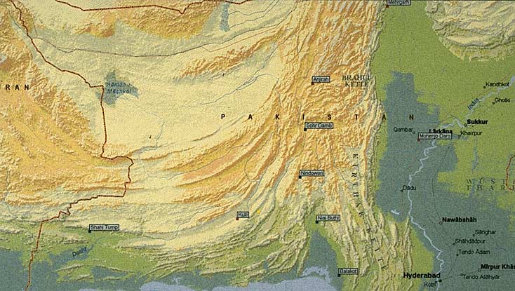
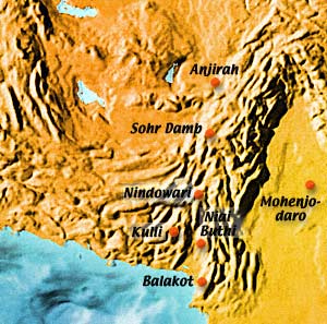
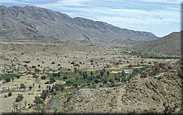
 The plain of Las Bela, or the Porali trough, is a triangular lowland embankment. Only in this plain true mounds are found. Sites located on the gravel plains have very shallow cultural deposits. Despite the rather fertile environment, the number of sites was surprisingly low. The most important prehistoric settlements are Adam Buthi, Niai Buthi, and Balakot. Balakot which is located 80km south of Bela on the Khurkera plain, is the only prehistoric settlement south of Bela. Adam Buthi, Muridani and sites dated to the Historic period and the so-called Edith Shahr A and B Complexes are situated north of Bela, closer to the mountains bordering the plain towards Jhalawan, while Niai Buthi lies more towards west. These zones are environmentally very different (16). |
|
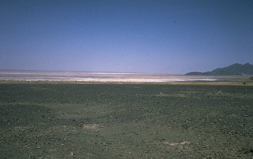
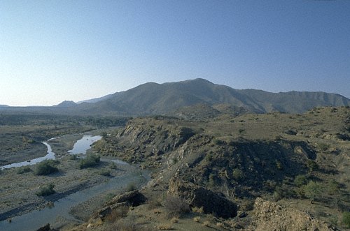
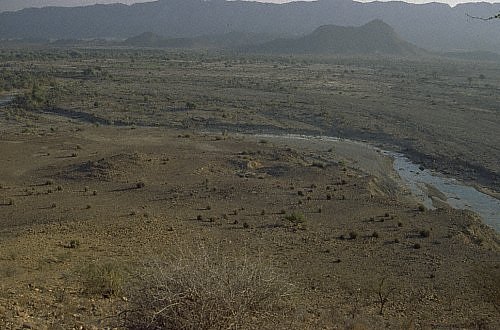
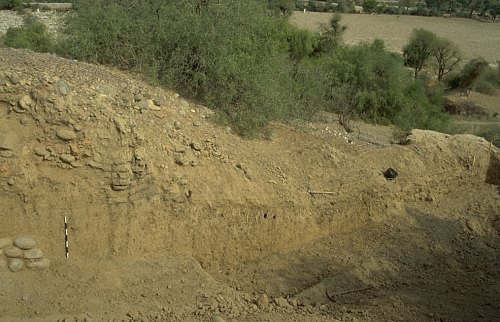
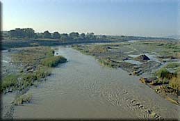 Apart from one Islamic site, Kaiara Kot, which was first noted by A. Stein, and sites dating back to the British Period, the southern central and eastern portions of Las Bela are devoid of archaeological sites. This part is flooded during rains and, south of Sirinda Lake, through tidal waters, turning the whole area into a large, inaccessable mud plain (17). These conditions seem to make the presence of sites unlikely, but, considering the fact, the the plain level on the Khurkera plain has risen since 3000 BC by about 8m, lower sites might well be buried under sediments in the central portion. The sedimentation rate appears to be much lower there, but the palaeo-drainage pattern of the perennial Porali and its tributaries and overflow channels has not yet been studied. > 4 |
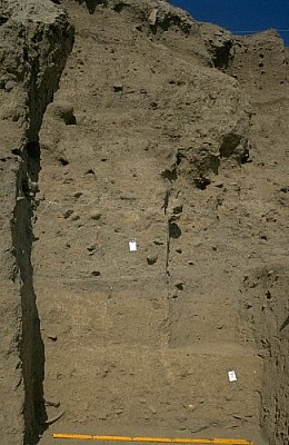
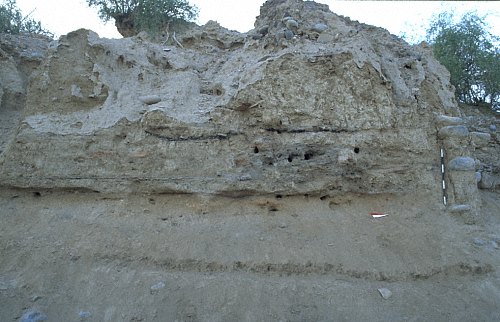
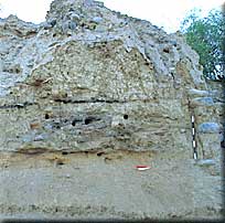
 Adam Buthi is the earliest site discovered in southeastern Balochistan (18, 19). It was occupied around the mid-4th millennium BC and abandoned around 3000 BC, well before the height of the ancient Indus Valley Civilization. |
|||||||||||||||||||||||
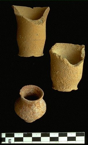
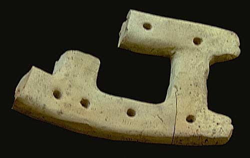
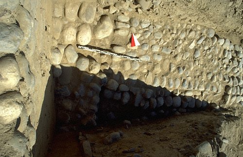
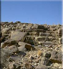
 It is a small (0.14 hectares), but high mound (7.5 meters). The sections revealed several phases of super-imposed, well-built stone houses terraced along the slope of the mound (20, 21, 22). Pottery is not very abundant. |
|||||||||||||||||||||||
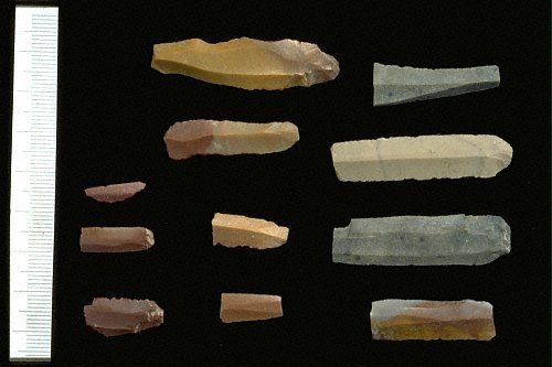
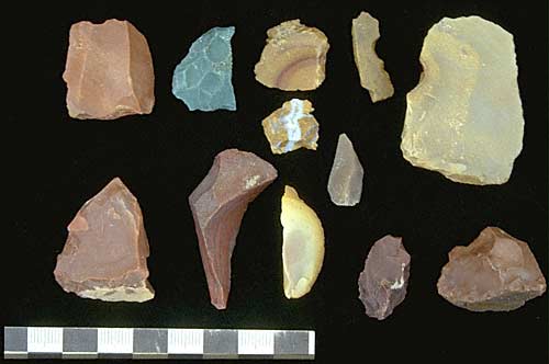
 The vessels are partly handmade, but the slow wheel was also used (23, 24). The shapes and the shiny red to violet slips resemble Kile Ghul Mohammad pottery from northern Balochistan, but, in general, the assemblage is a distinctive local production. The surface of the site is covered with several blades and flakes indicating an extensive silex industr
|
 After Mohammad Ibn al-Qasim had conquered Makran and Sindh in 712 AD, many sites continued, or started, to flourish (113, 114, 115, 116). However, as during the previous times, very little is known about the peripheral and remote areas. In Sindh Kohistan, the Hab Valley, and in the plain of Las Bela we found the remains of a few settlements or fortifications which can be dated to the 12th/13th and the 17th/18th century AD, but in the Kanrach, Bahlol and Loi Valleys no such sites were discovered. |
|
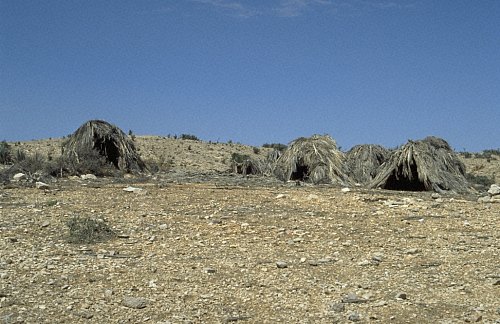
The only remains are hundreds of camp sites, marked by a few stones which were aligned to benches, and by a few potsherds (117, 118, 119). |
|
 The pottery is similar to types found in southern Sindh, in the Indus delta and in Banbhore. The date applied to this red micaceous, black painted pottery ranges between the 13th and 18th century AD. Whether this shift to pastoralism is related to the immigration of the Baluch tribes from the west, to the invasion of Turkish tribes such as the Ghaznavids and Mongols who destroyed the oasis cultures of interior Makran and caused larger population movements towards Sindh, or to an overall change in the economic, social and political structure is unknown. |
|
| In the 17th century AD, Mir Ahmad, the leader of a Brahui tribal confederation founded the Ahmadzai Khanat of Kalat, to whom the Jam of Bela paid tribute. |
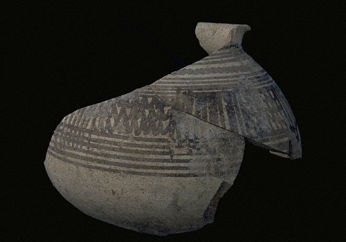
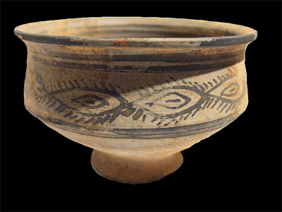
 Most sites in northern and central Balochistan were abandoned around 2600 BC. This development is probably related to the expansion of the Indus Civilization. Southern Balochistan, however, continued to be inhabited by a people labelled "Kulli." This cultural complex is named after a site in Kolwa which was discovered by Aurel Stein. Since then, several other sites became known from Makran to southern Kalat, to Nausharo in the Kachhi plain, and to the eastern foot of the Kirthar Range in southwestern Sindh. Some motifs and vessel shapes found in southeastern Iran and on the Arabian Peninsula, are sometimes also linked to the Kulli and seen as indications for long-distance contacts. |
||||||||||||||
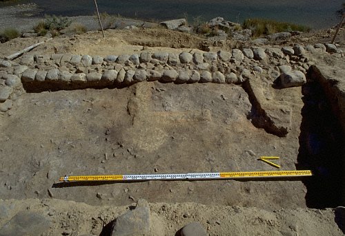
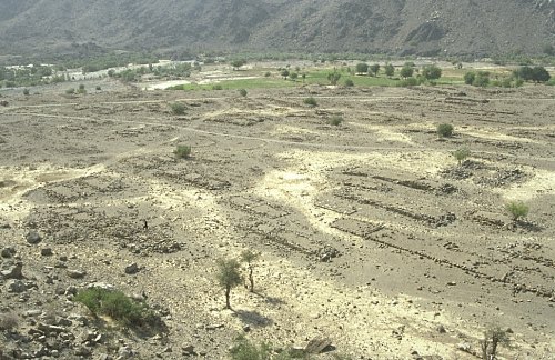
 Several Kulli sites were discovered in our survey area (64). As a matter of fact, this phase coincided with the maximum number of settlements. The large number of settlements alon with the developed plan and large size of a couple of sites, in particular in the Hab- Saruna Valley, added a new and unexpected dimension to this complex. The lay-out of some sites resemble the plan of Harappan sites: Rows of houses are built along lanes and streets, which are sometimes paved. Sometimes, stairs provide access to upper terraces (65). Building materials were large ashlars or boulders, and the houses are often preserved to a considerable height. |
||||||||||||||
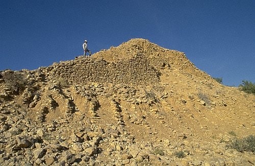
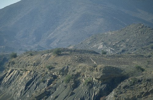
Many of these sites are located in strategic positions, on top of mountains or terrace hills, overlooking the valleys and controlling the plains and passes (66). Other sites are small hamlets built in the open plain. Although they have no defenses, they are of a very compact appearance. Most sites are associated with dams. |
||||||||||||||
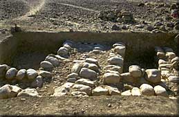
| | Bakkar Buthi | Bakkar Buthi is a small Harappan site located in the Kanrach Valley, a remote area bordered by the Mor and Pab Ranges. |
||||||||||||||
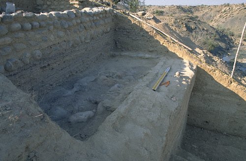
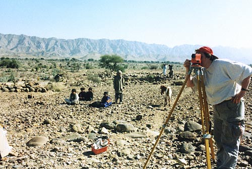
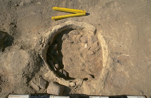
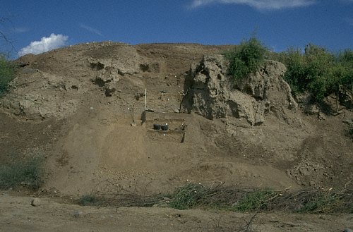
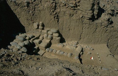
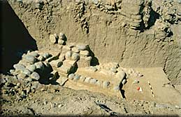
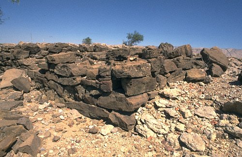
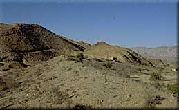
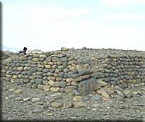
 The site overlooks the valley from a terrace hill above the Kharari River, near the watershed of the Windar River (67). It was founded on the alluvium, but a small early third millennium BC site was discovered across the Kharari. Bakkar Buthi comprises of a fortified southern part and a couple of houses and working spaces which are obviously related to chert production to the north (68). Two trenches dug in 1998 revealed several building phases built above a fine grained alluvial silt deposit (69)). Whereas the mudbrick and stone walls of the earlier phases were well-built (70, 71), the standards decline in the uppermost level where pottery and broken stones were also used for building (72). |
||||||||||||||
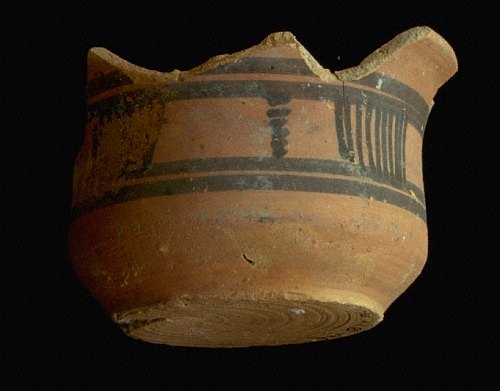
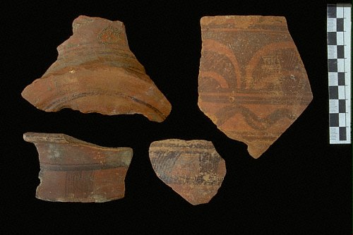
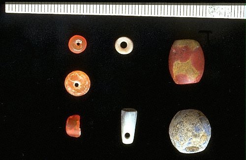
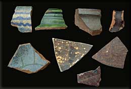
| The site is remarkable for its lay-out and the predominantly Harappan character of the pottery. Much of the pottery is identical to pottery from urban centers such as Mohenjo-Daro and Harappa, but wasters indicate also a local production (73, 74, 75, 76, 77). Kulli elements (78, 79) are more prominent than at Balakot, but, altogether, the assemblage is clearly different from that found on "classical" Kulli sites. A date between ca. 2400 and 2000 BC is supported by the radiocarbon samples. (80, 81, 82, 83, 84). | ||||||||||||||
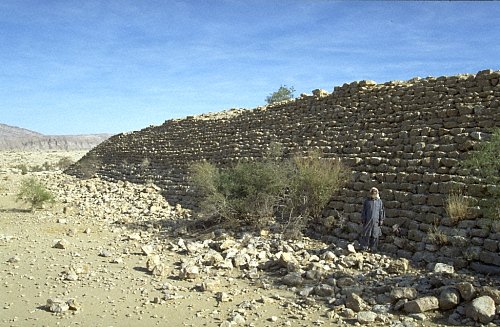
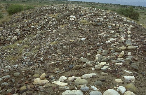
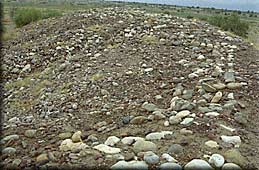
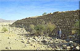
 About 200m to the south, in an old and now dry meander of the Kharari River an impressive dam blocked the river just before its entrance to the Kanrach Valley. The huge dam which is the easternmost in a series of three dams, betrays a well advanced level of hydraulic engineering (85). |
||||||||||||||
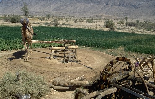
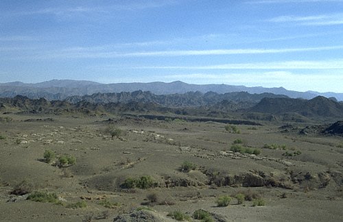
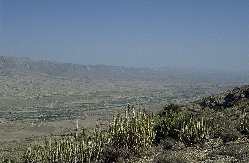
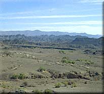
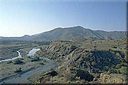
| | Greater Hab Valley | Following the Hab River from its mouth at the Arabian Sea towards north, the wide and fertile valley slowly rises and becomes intersected by spurs and several tributaries. North of the Bhootani Petrol Station, at the entrance to the Wirahab Valley, the typical topographical features, such as large north-south running river valleys and steeply rising mountain ranges take shape. The Andhar Range (86) which is marked by a flat top and deep fissures, rises to 1250m amsl, while the Kirthar and Khude Ranges reach 1400 meters and 1600 meters above seal level. The Hab Valley is wider and less steep than the Kanrach Valley. It thus has better potential for the accumulation of sediments and agriculture. |
||||||||||||||
 During the surveys carried out in 1998 and 1999, 106 sites were discovered. Chronologically and culturally, they belong to the same horizon as the sites in the Kanrach Valley and the Las Bela plain. No real mounds were found, but, in general, the settlements tend to be larger than in the other areas (87,88), and in Sind Kohistan. This is in particular true for the Kulli sites which cluster in large numbers between Dureji and Barag, and at points where tributaries such as the Loi, Bahlol, and Saruna Rivers enter the Hab Valley. During the surveys carried out in 1998 and 1999, 106 sites were discovered. Chronologically and culturally, they belong to the same horizon as the sites in the Kanrach Valley and the Las Bela plain. No real mounds were found, but, in general, the settlements tend to be larger than in the other areas (87,88), and in Sind Kohistan. This is in particular true for the Kulli sites which cluster in large numbers between Dureji and Barag, and at points where tributaries such as the Loi, Bahlol, and Saruna Rivers enter the Hab Valley.Nowhere were similarly large, nucleated towns found in such large numbers (89, 90, 91, 92). These settlements apparently formed a network controlling the access routes between Sindh and interior Balochistan. Unvariably, they are associated with dams, some of which are true masterpieces of construction (93, 94, 94b). The pottery and objects found at these sites are clearly related to Harappan types (95, 96,97, 98), but the fabric is usually coarser, the variety of shapes and motifs is smaller, and a number of local elements are also present. > 7
|


قلعه سب زیباترین و سالمترین قلعه یی است که از دوران اسلامی سیستان و بلوچستان باقی ماندهاست.این قلعه که یادگار حاکمان صفویه و بعد از آنها است، از جمله ۲۷ بنای تاریخی این منطقه است که پا بر جا می باشد.

قلعه سب روی صفحه یی سنگی و صخره طبیعی کم ارتفاع با خشت و گل در قرن دوازدهم هجری قمری ساخته شد و در پایان قرن سیزدهم آخرین تغییرات اساسی در آن صورت گرفت. ساختمان قلعه مجموعه یی از حصار و بنای اصلی است که با ۲۳ متر ارتفاع در روستای «سیب» ۲۵کیلومتری جنوب غرب سراوان قرار دارد.

بنای اصلی قلعه در قاعده، به صورت مستطیل ۳۶ متر* ۲۵متر، در دو طبقه ساخته شدهاست. به گونه یی که هرچه بر ارتفاع آن افزوده میشود از حجم آن کم میشود و در ظاهر به شکل «مصطبه هرم» درمی آید که موجب ایستایی بیشتر بنا و جلوگیری از رانش دیوارهای قطور و مرتفع آن میشود.

معماران چیره دست محلی با بهره گیری از تجربه خود، برای احداث قلعه سب تخم گیاهی به نام «توتری» را با گل مخلوط میکردند و ملاطی چسبناک میساختند که وقتی خشک شد، شدیدترین رگبارها و بارانهای فصلی بلوچستان نیز توانایی شستن آن را ندارد و به همین دلیل قلعه پایدار ماندهاست.

حصار قلعه سیب با سه متر ارتفاع ۴۸ متر*۷۴متر به شکل مستطیل، دورتادور قلعه را فراگرفتهاست، و به وسیله غلام گردهای (محلی ویژه نگهبانان و تیراندازی) در داخل دیوار و چهار برج چهارگوش در چهار رأس حصار از قلعه محافظت میکنند.

سازندگان قلعه همچنین با بهره گیری از تنه خرما و شاخ و برگ آن وگاهی حصیرهایی از داز DAZ (نخل کوتاه وحشی)، سقفها را میپوشاندند و روی آنهارا از کاهگل پوشش میدادند.

محل ورود به قلعه تنها از طریق پلکان جنوب شرق امکان پذیر است و واردشوندهها پس از عبور از درب اصلی قلعه به وسیله معبری به درگاهی، در سمت میانی دیواره غربی و از آنجا به وسیله یک راهرو تونل به طول ۱۶/۵متر با شیب نسبتاً تند به حیاط مرکزی میرسیدند. همچنین برای دسترسی ساکنان قلعه به آب شیرین چاهی در دل صخره و حیاط مرکزی حفر شدهاست.

قلعه سب در مجموع ۱۰ اتاق کوچک و بزرگ دارد که در اطراف حیاط مرکزی جای گرفتهاند و برای دسترسی به فضاهای حاکم نشین و تابستانی، راه پله یی، مخفی، کم عرض، با شیب زیاد وجود دارد. قلعه سب بعد از زمان صفویه بویژه در عصر افشاریه محل سکونت حاکمین بودهاست.


 March 2009April 2009
 May 2009June 2009
 July 2009August 2009
 September 2009October 2009
 November 2009December 2009
 January 2010February 2010
 March 2010April 2010
 May 2010June 2010
 July 2010August 2010
 September 2010October 2010
 November 2010December 2010
 January 2011February 2011
 March 2011April 2011
 May 2011June 2011
 July 2011